DEPARTMENT
AERIAL SURVEY
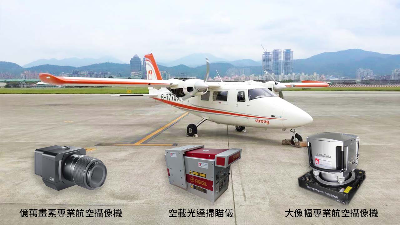
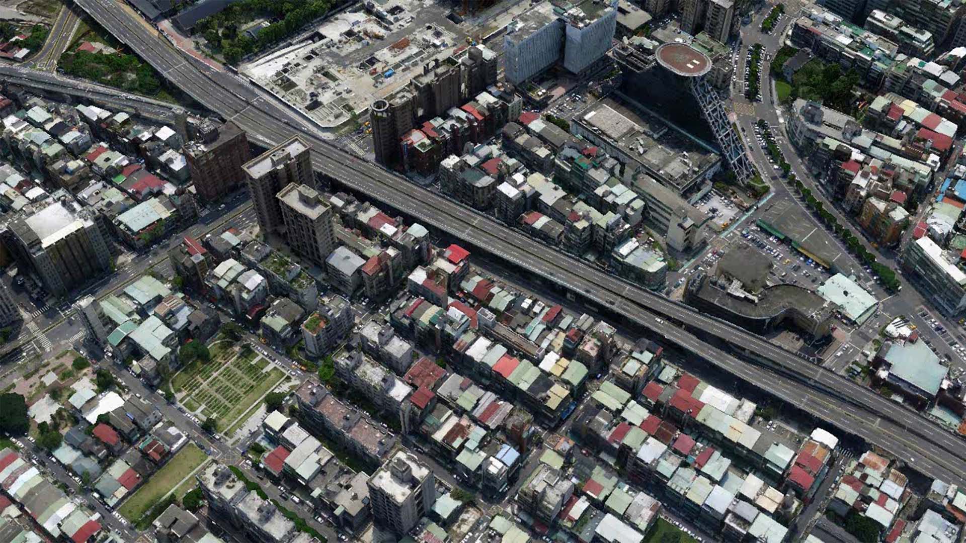
Aerial photogrammetry is a highly mature technology in Taiwan, capable of rapidly acquiring large-scale surface information. Our company has made significant investments in advanced equipment, operating a professional fixed-wing aerial survey aircraft (P68C-TC), two full-waveform airborne LiDAR systems (Riegl LMS-Q780 and Riegl LMS-Q680i), and eight digital aerial survey cameras, including UltraCam-Xp, PhaseONE IXA 180, and IGI-DigiCAM.
In February 2018, we further expanded our capabilities by acquiring five Phase ONE iXU-RS 1000 professional aerial cameras, capable of capturing ultra-high-resolution images in multiple orientations — producing imagery in the gigapixel range. These datasets enable the generation of high-resolution orthophotos, high-precision DEMs, and detailed 3D stereoscopic models, widely applied in terrain change monitoring, topographic mapping, land-use analysis, and more.
With a dedicated aerial operations team and extensive flight experience, our company has established itself as a key player in Taiwan’s aerial photogrammetry industry.
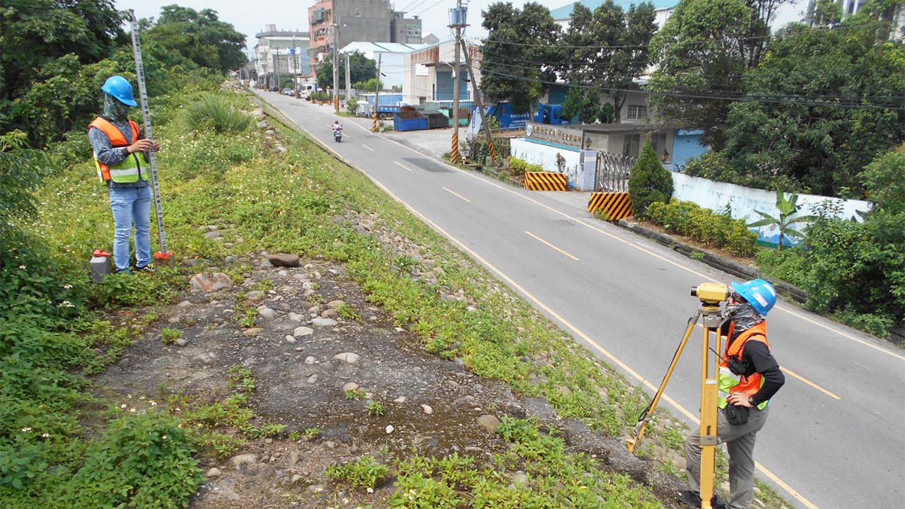
LAND MEASURING
With the rapid advancement of technology, modern surveying has evolved to include numerous cutting-edge techniques such as LiDAR and aerial photogrammetry. While traditional surveying methods remain widely practiced across most surveying companies, they still hold an irreplaceable and essential role within the field.
As the saying goes, “To do a good job, one must first sharpen their tools.” — all of our surveying instruments are independently owned and operated, ensuring full control, precision, and reliability in every project.
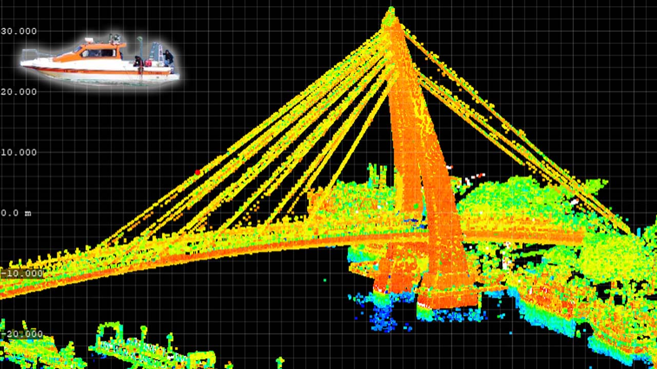
MARINE INVERTIGATION
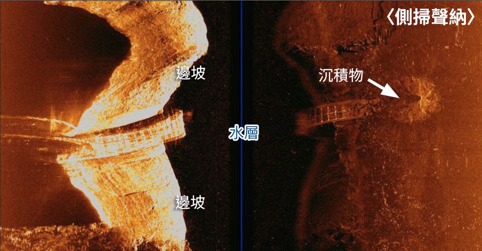
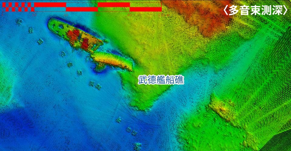
Our hydrographic surveying services encompass a wide range of underwater measurement and analysis technologies, including bathymetric mapping, side-scan sonar, sub-bottom profiling, magnetometer surveys, remotely operated vehicles (ROV), oceanographic investigations, and tide observations.
With substantial investment in research, development, and technical collaboration, our company delivers professional and high-quality surveying results across diverse applications such as channel dredging, harbor construction, fishery development, coastal utilization, reservoir sediment management, coastal defense planning, and marine scientific research — establishing ourselves as one of the leading pioneers in marine surveying and research in Taiwan.
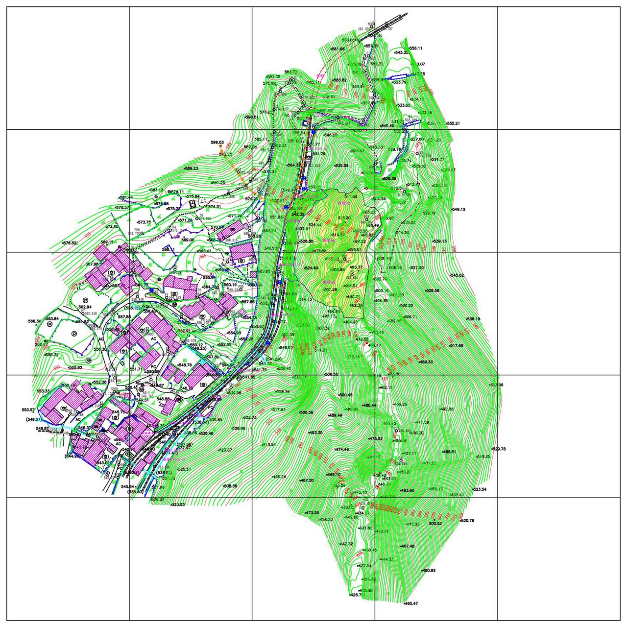
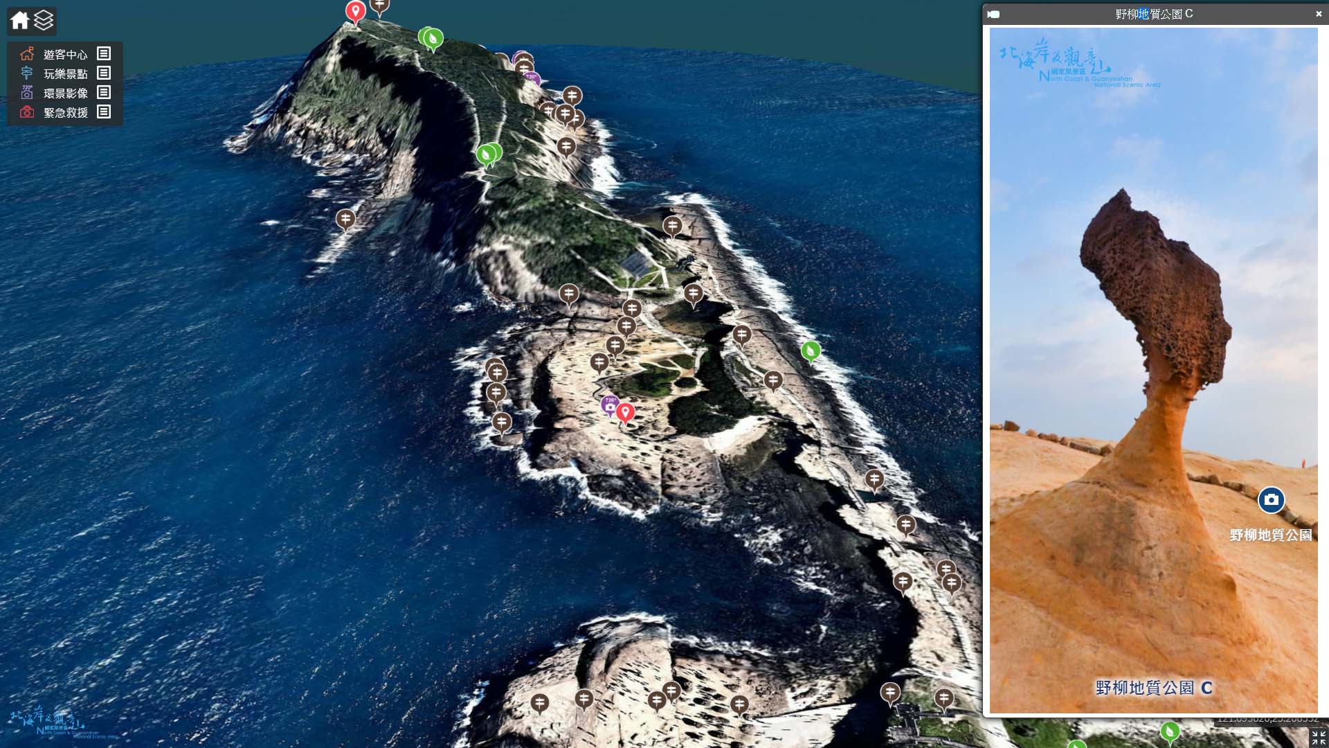
3D GEOGRAPHIC INFORMATION SYSTEM
At present, a Geographic Information System (GIS) represents spatial data — points, lines, and polygons — in digital form to convey geographic locations and attribute information.
In recent years, GIS technology has evolved beyond traditional mapping by integrating analytical tools, layered data visualization, and expanding from stand-alone systems to web-based platforms for broader accessibility. However, as technology advances, 2D representations alone are no longer sufficient to meet modern spatial analysis and visualization demands, leading to the development of 3D GIS.
A 3D Geographic Information System builds upon the foundation of 2D GIS, focusing on the acquisition, storage, management, analysis, and realistic visualization of large-scale geographic environments. Through 3D modeling techniques, it faithfully represents the physical form and spatial relationships of buildings and landscapes in a vivid, three-dimensional context.
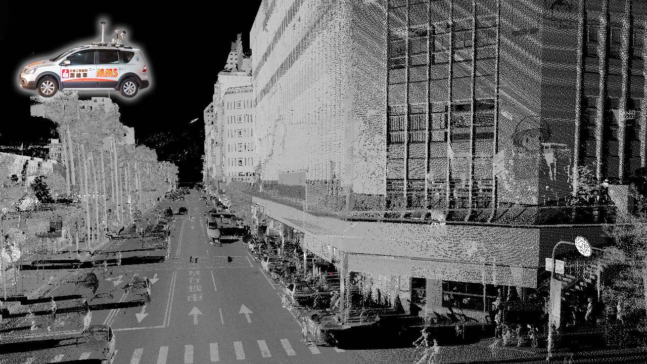
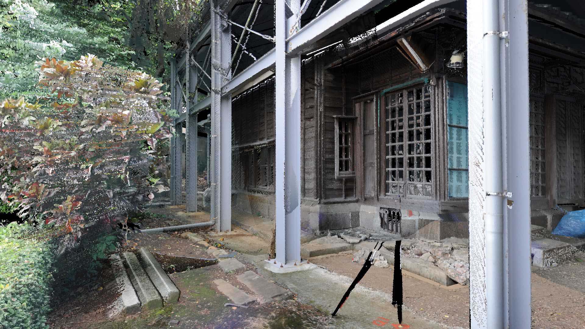
LASER SCANNING
3D laser scanning utilizes a laser rangefinder that emits laser beams and simultaneously receives the reflected signals from target surfaces to measure the distance between the instrument and the object. By calculating the slope distance from the scanning station to each scan point within the effective or standard range, the system derives the three-dimensional spatial coordinates of each point relative to the station.
With its advantages of high precision, rapid data acquisition, and dense sampling, 3D laser scanning has become a major trend in modern surveying technology.
Since 2007, our company has invested in this technology and even developed proprietary mobile scanning platforms, greatly enhancing mobility and operational efficiency. Through the application of this advanced laser scanning method, our results are no longer limited to 2D representations, but now offer richer data value and greater application potential across multiple fields.

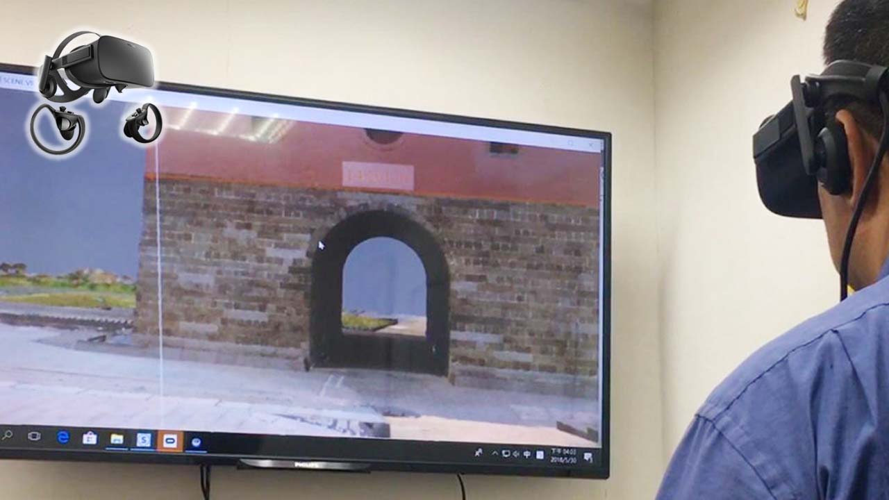
THE NEW MAPPING TECHNOLOGY
See it, reach it, capture it — what you see is what you get.
Featuring high-precision geolocation, seamless visual integration, and modular equipment design for flexible mounting and rapid calibration, this system enables the safe and efficient acquisition of real-time geographic information.
It has been widely applied in road facility surveys and database construction, topographic map updating, digital city modeling, indoor navigation, and virtual reality development. When integrated with 3D GIS platforms, it supports a broad range of multi-purpose applications.