PROJECTS
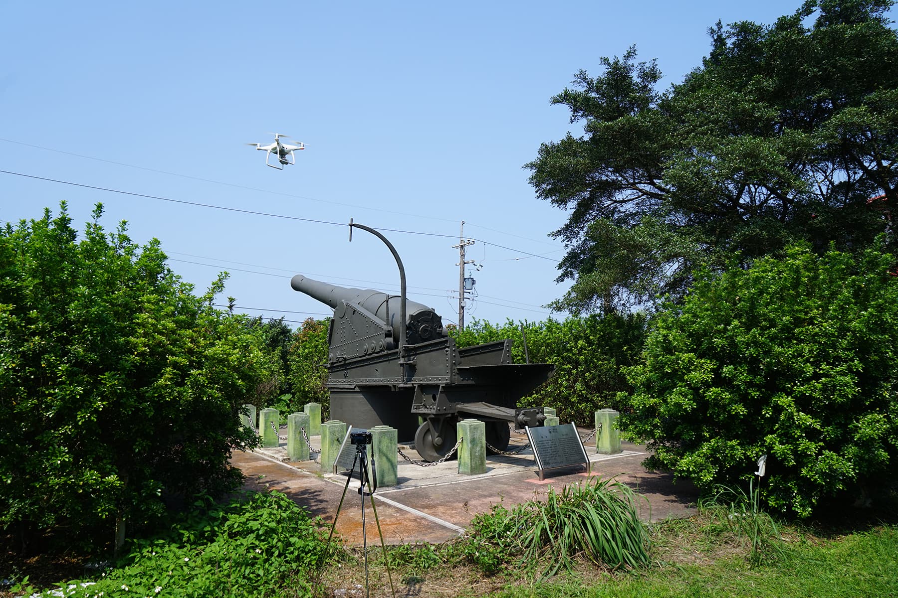
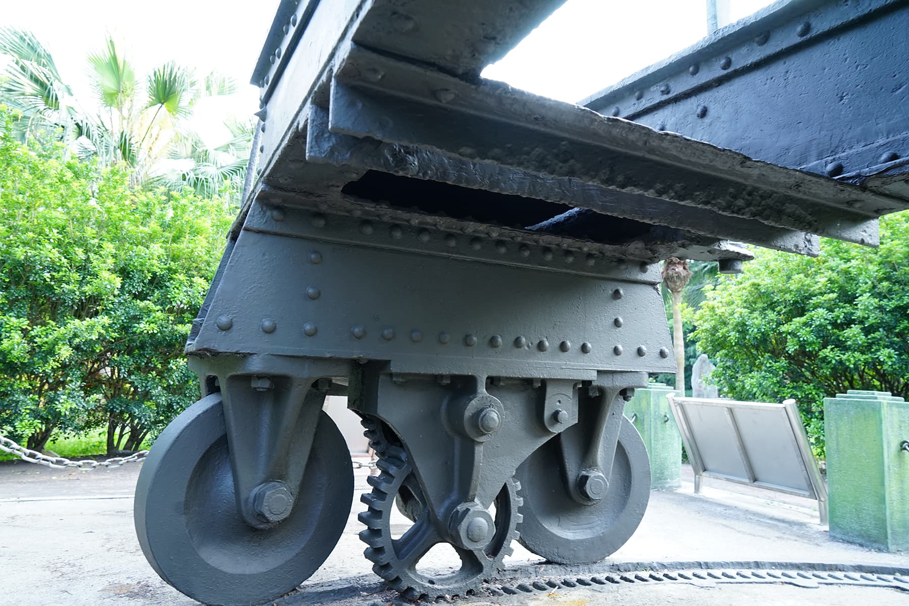
the Cultural Heritage Preservation of Keelung Shawan - Armstrong's Rifled Breech Loader
Project Date : 20190620
Project Commission : Keelung City Cultural Affairs Bureau
The “Greater Keelung Historical Scene Reconstruction and Integration Project” aims to utilize digital technologies to establish comprehensive archives and visual representations of cultural resources. This serves not only as a crucial foundation for the initial phase of historical site documentation, but also as the basis for defining standardized digital file formats across all subprojects, ensuring consistent and integrative presentation of project outcomes.
The digitization of the Armstrong 8-inch breech-loading cannon is one of the subprojects under this initiative. The detailed scope of work includes:
3D laser scanning and digital measurement
Point cloud data sharing protocols
Support for point cloud data import/export
Point cloud data visualization methods
Digital modeling of the historical cannon
Photogrammetric digitization
By employing aerial photogrammetry and 3D laser scanning technologies, this project digitally preserves this historically significant artifact in high-precision 3D form, capturing fine surface details and accurate dimensions. Furthermore, the digitized model can be converted into 3D-printable formats and scaled for design adaptations, enabling value-added applications such as cultural and creative product development.
Work Record - Taipei Western District Gateway Project 3D City Models
Project Date : 20180327
Project Commission : Department of Urban Development
In recent years, the Taipei City Government has been actively promoting the “West Gateway Project”, centered around the Taipei Main Station transport hub—where five major rail systems converge—and the surrounding historic architecture near the North Gate (Beimen). The initiative aims to reshape and redefine the urban image of Taipei’s western district.
Beginning in 2014, the demolition of the Zhongxiao Bridge ramp unveiled the elegant classical facades of Beimen and the Beimen Post Office, restoring their historical prominence. Subsequently, the city undertook the redesign of Zhongxiao West Road and the construction of various plaza landscape projects, including the Traveler’s Plaza and Jiao-Ba Plaza.
By the end of 2019, the West Gateway Project reached completion — unveiling a new metropolitan gateway that embodies Taipei’s spirit of openness, inclusiveness, and people-centered urban design.
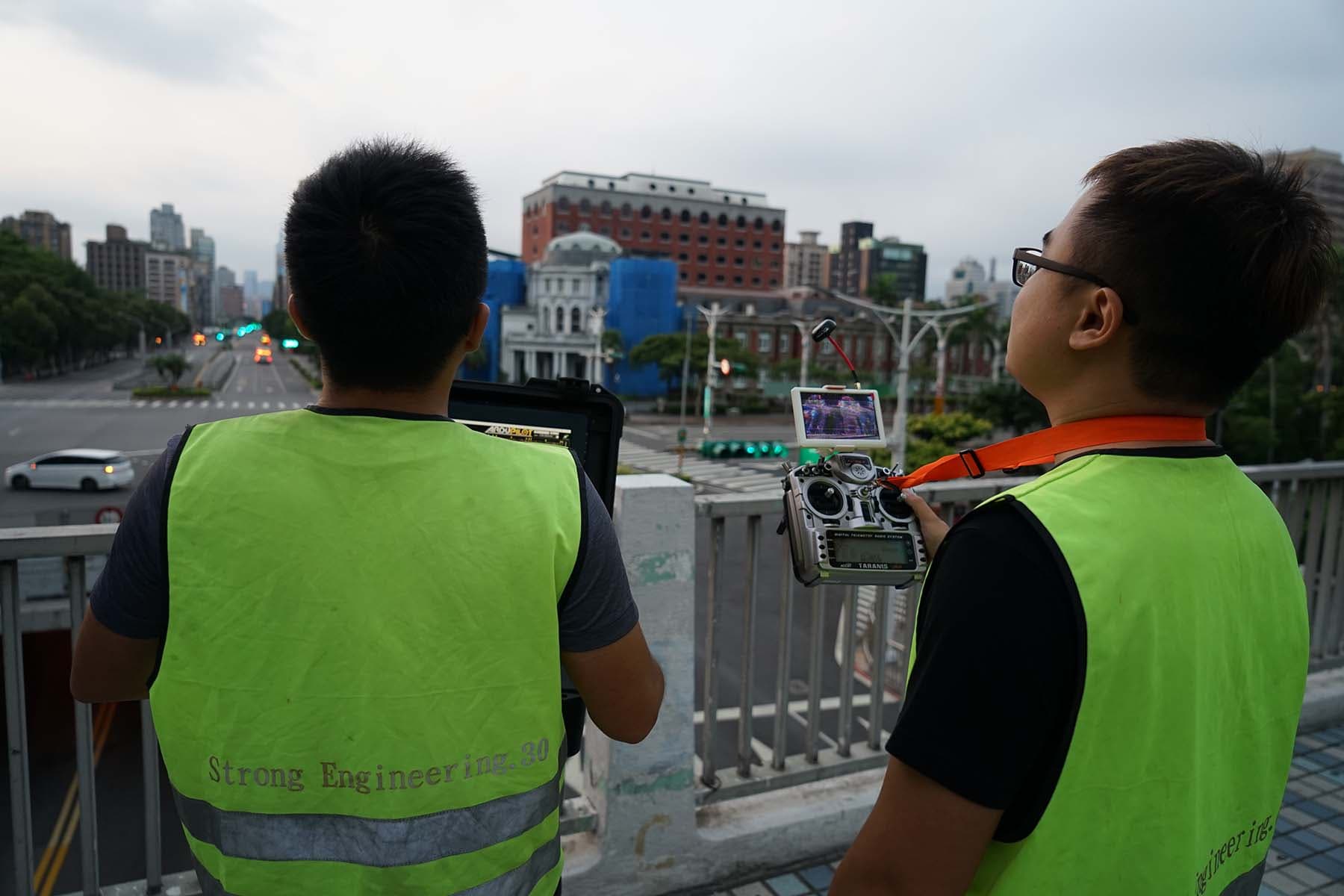
As a key initiative in recent urban development, the “Taipei West District Gateway Project” stands as an important milestone in Taipei City’s urban planning efforts. In an innovative move, the city government commissioned the creation of a high-precision 3D model to digitally preserve the current state of the area and to serve as a three-dimensional platform for future urban planning and policy communication.
In 2018, our company was entrusted with this task, utilizing a tri-axis, six-rotor UAV equipped with an oblique camera system. The project area extended from Civic Boulevard in the north to Zhongxiao West Road in the south, from Xinsheng North Road in the east to the Tamsui River in the west, covering a total area of 120 hectares.
The work involved aerial photography by UAVs, combined with ground control point surveys to ensure geometric accuracy. The collected imagery was then processed through specialized photogrammetry software to produce a detailed three-dimensional digital model.
This 3D model digitally archives the current state of the city. Beyond allowing users to freely rotate, zoom, and measure the model, it can also be integrated into virtual reality (VR) environments, opening up endless possibilities for diverse and value-added applications.
This project serves as an outstanding example of using UAV technology to construct a highly detailed 3D urban model, with “safety” being the top priority. The project area includes several central government buildings, lies adjacent to the Bo’ai Special Zone, and is located directly beneath the flight path of Songshan Airport. On the ground, it covers Taiwan’s busiest transportation hub, with over 500,000 daily commuters.
Due to these sensitive conditions, all UAV operations were required to strictly comply with aviation and national security regulations. Flights could only be conducted within a one-hour window in the early morning, under stringent restrictions on lighting and takeoff locations. Despite these challenges, our team worked with unwavering dedication and completed the aerial photography on schedule.
The second highlight of this project is its remarkable level of detail. The final 3D model showcases realistic buildings, with accurate surface textures and structural details—even the thickness of signage lettering is clearly visible. From the 245-meter-tall Shin Kong Tower, every element is faithfully reproduced—from the spire at the top down to the pavement tiles at the main entrance.
This project represents one of the most detailed large-scale 3D urban models in Taiwan, created entirely through aerial imagery-based photogrammetry. It stands as a perfect demonstration of our company’s expertise in UAV operation, photogrammetric processing, and 3D modeling technology.

Overseas Projects - Specific Surveying Project on River Loes, Timor-Leste
Project Date : 20180327
Project Commission : Democratic Republic of Timor-Leste
The Democratic Republic of Timor-Leste (Portuguese: República Democrática de Timor-Leste) is a country located at the eastern end of the island of Timor in Southeast Asia, sharing a land border with Indonesia. It was once one of only two Portuguese colonies in the Far East (the other being Macau). In 1974, Portugal began its policy of decolonization, giving up its overseas territories, which led to the independence of various former Portuguese colonies around the world.
Timor-Leste declared independence from Portugal on November 28, 1975, establishing the Democratic Republic of East Timor, but was invaded and occupied by Indonesia only nine days later, becoming Timor Timur Province in July 1976. Over the following two decades, the region was marked by resistance movements and a prolonged war of independence, resulting in between 100,000 and 250,000 deaths. In August 1999, with the support of countries such as Australia, a referendum was held in which the people voted for independence. Timor-Leste officially became independent from Indonesia on May 20, 2002, and was admitted to the United Nations on September 27, 2002, becoming the 191st UN member state. Since then, the nation has gradually moved toward stability.
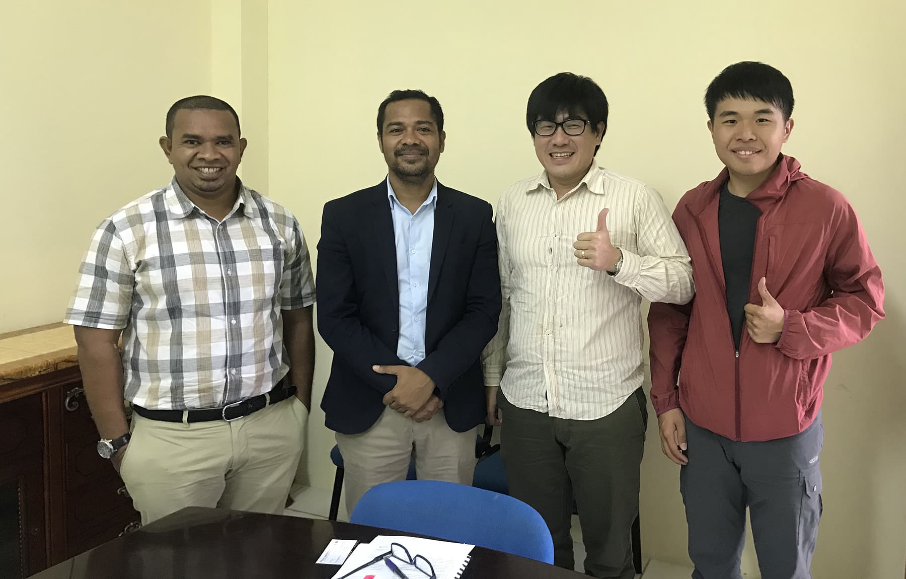
As a pioneer of Taiwan’s surveying and mapping industry in expanding internationally, our company established a presence in Timor-Leste in 2016, overcoming numerous challenges. Beyond exporting Taiwan’s advanced geospatial services, we have also been dedicated to enhancing local technical capacity, fostering a spirit of shared growth and collaboration that continues to this day.
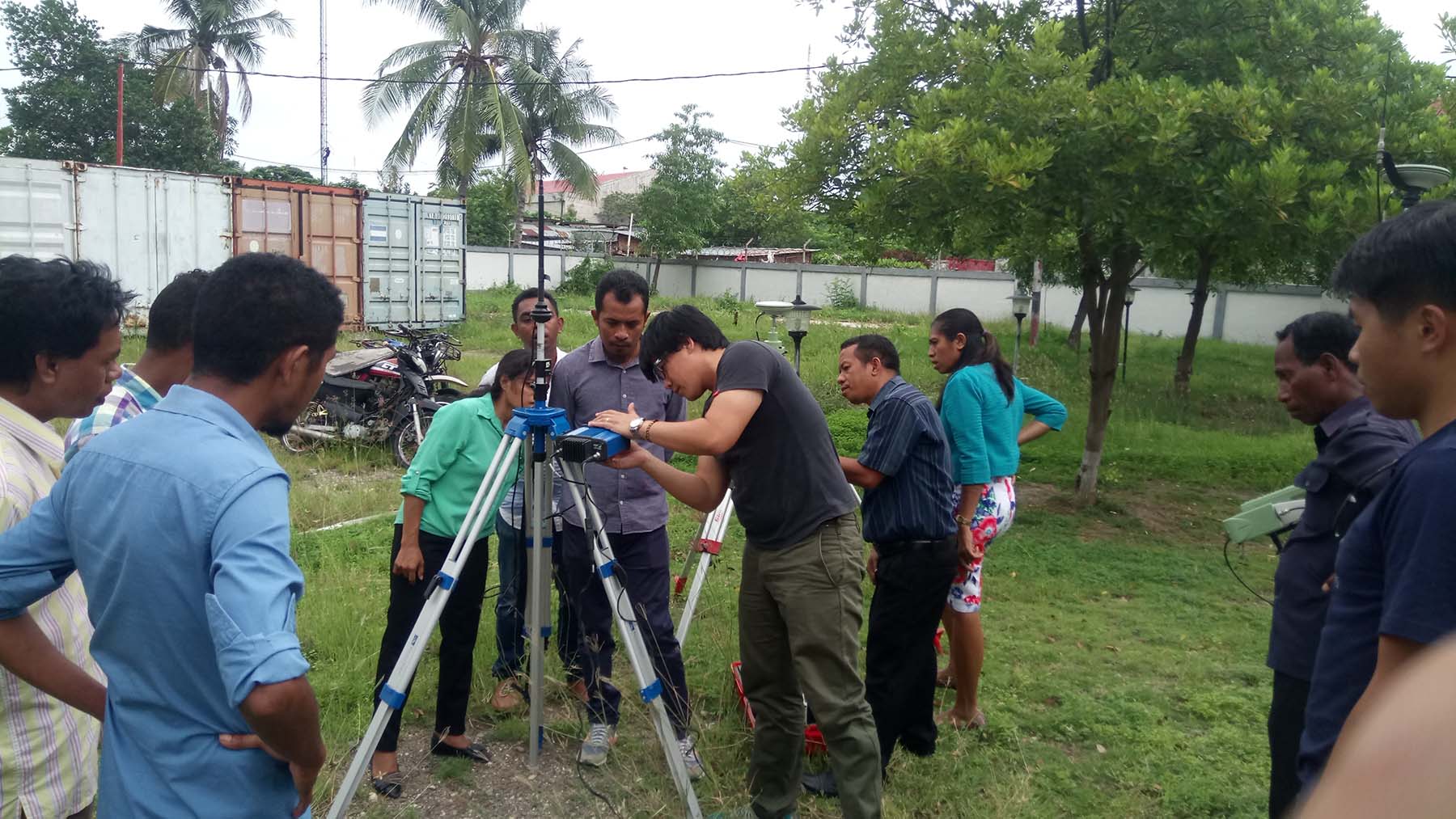
In 2018, the Ministry of Minerals of Timor-Leste initiated a major development plan for River Loes, the country’s largest river, seeking foreign investment but lacking reliable topographic data. River Loes flows through both Timor-Leste and Indonesia, with a drainage area of nearly 20,000 square kilometers. Due to the remoteness of the region, traditional ground surveying methods were prohibitively expensive. Therefore, based on our local branch’s proposal, the project adopted UAV-based aerial mapping, combined with GPS observations and ground LiDAR systems, to survey 3,000 hectares of key downstream land.
The project was completed within a short timeframe, delivering high-quality topographic maps, river cross-section data, and high-resolution orthophotos. These outputs not only supported the Ministry of Minerals in river infrastructure and aggregate resource planning, but were also utilized by the Ministry of Agriculture for agricultural development and land lease management. The exceptional results received high praise from the client and were later recognized by the National Directorate of Land and Property (Propriedade e Serviços Cadastrais) as an official research and training project.
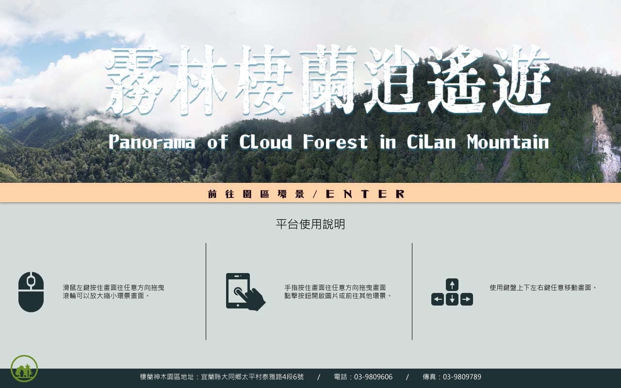
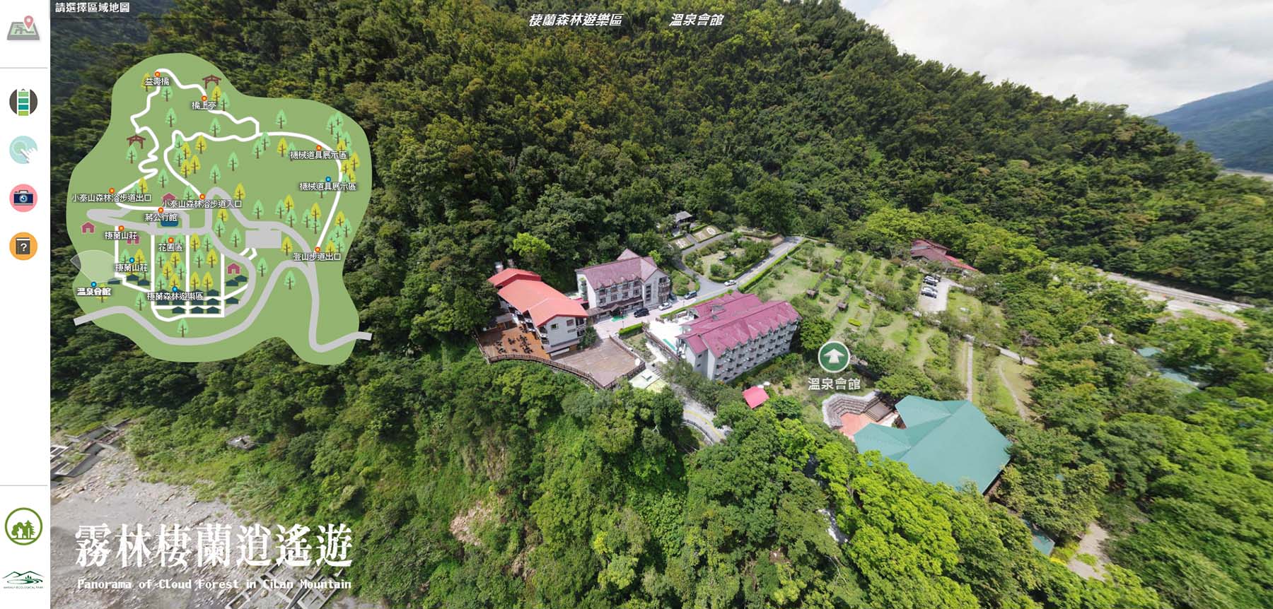
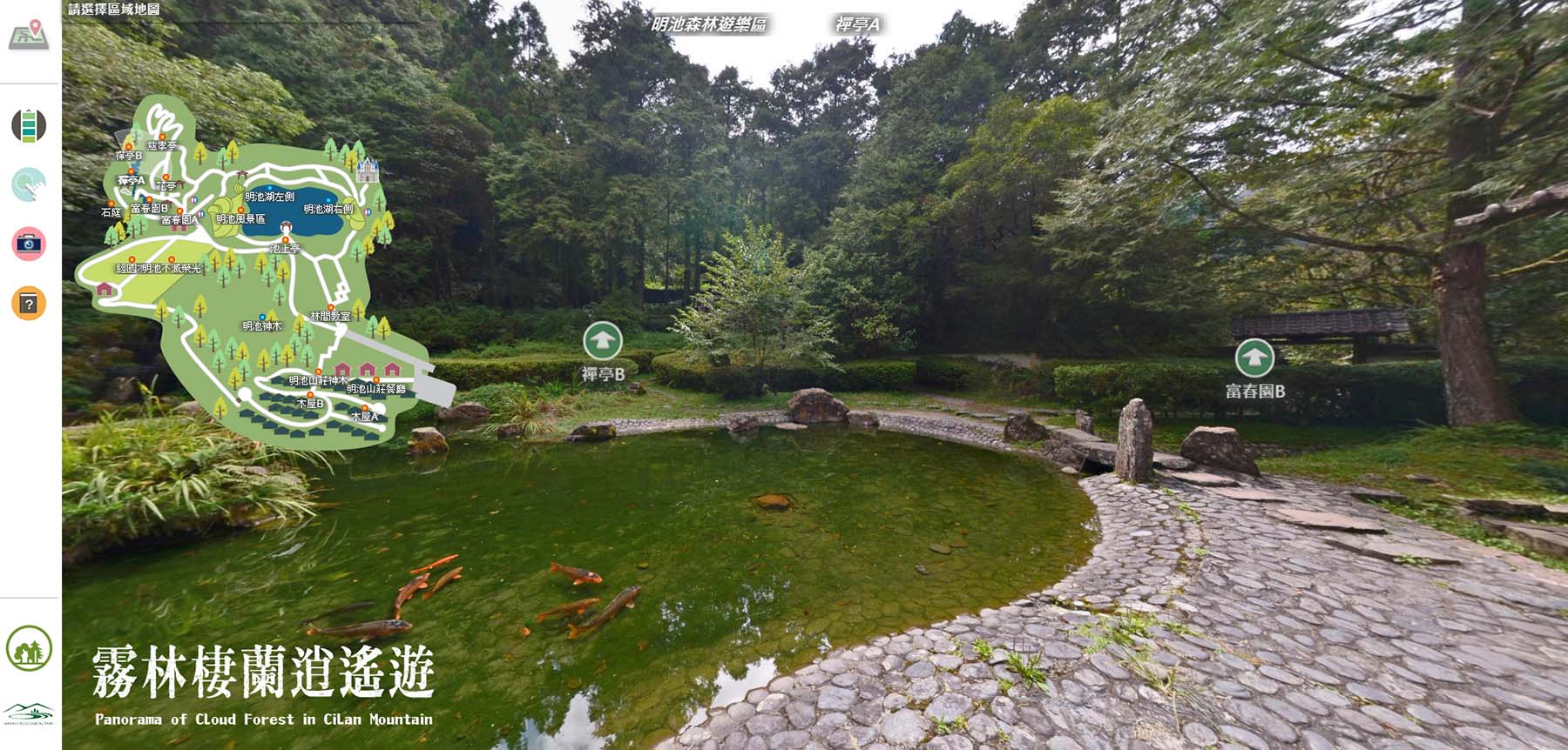
Panorama of Cloud Forest in Cilan Mountain
Project Date : 20181228
Project Commission : Forest of Central Cross-Island Highway and Development Administration, VAC
Starting with the creation of the “Cilan Sacred Trees Park” panoramic tour, the project has undergone continuous maintenance and expansion over the years. By the end of 2018, it was fully integrated into a new panoramic platform titled “Misty Forest Cilan Journey” (Wulin Cilan Xiaoyao You).
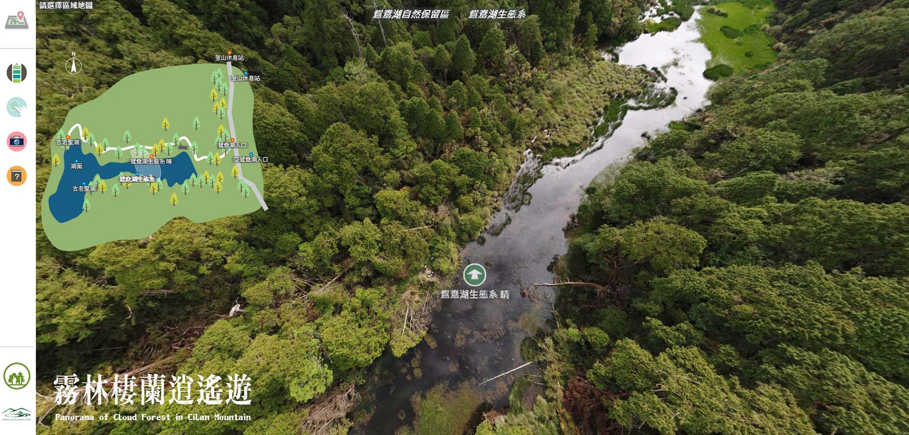
In addition to the original Cilan Sacred Trees Park, which provides comprehensive and detailed information about the ancient trees, the platform has gradually incorporated several new areas — including the Yuanyang Lake Nature Reserve, Cilan Forest Recreation Area, Mingchi Forest Recreation Area, Provincial Route 130 – Hinoki Classroom, and Provincial Route 160 – Home of the Hinoki Cypress. Step by step, interactive panoramic content—both aerial and ground-based—was integrated into the latest system. Whether or not visitors have personally traveled to these sites, the platform offers an immersive, lifelike experience, as if wandering through the mystical misty forests themselves.
In addition to the information-rich panoramic system, Unmanned Aerial Vehicles (UAVs) were also employed to capture aerial documentary footage and to survey forest resources in the Cilan Mountain area. The diverse and abundant datasets collected through this project will serve as valuable assets for future forestry management and conservation planning.
〈It is recommended to view this platform using a desktop computer, laptop, or tablet for the best browsing experience."Panorama of Cloud Forest in Cilan Mountain"〉
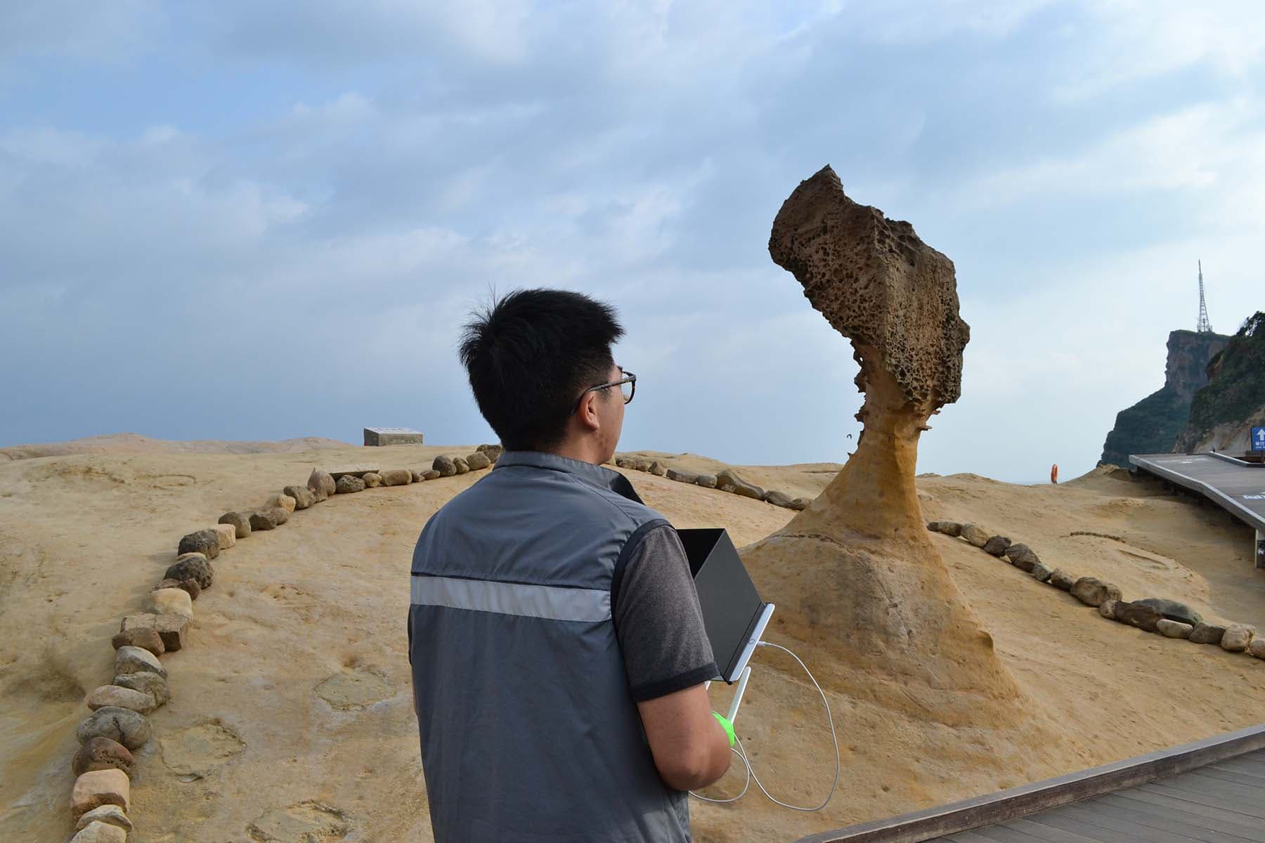
National Scenic Area - Yehliu Geopark 3Dmodel
Project Date : 20180420
Project Commission : North Coast and Guanyinshan National Scenic Area Headquarters
This project utilizes original aerial imagery to create high-precision 3D terrain models, showcasing the realistic landscapes of several renowned attractions along Taiwan’s North Coast. In addition to the Yehliu Geopark featured in the video above, the 3D modeling area also covers Shalun Beach in Sanzhi, Jinshan, and Wanli coastal regions.
Taiwan’s most iconic natural landmark — the “Queen’s Head” — was also re-scanned using 3D laser scanning technology during this project. The newly acquired point cloud data can be compared with data from previous years to serve as a reference for analyzing, studying, and restoring the rock’s weathering condition. Furthermore, these point cloud datasets can be applied in 3D printing to produce physical models.
Within the project area, multiple interactive panoramic images—both aerial and ground-level—were captured across major scenic spots. These are integrated with visitor center information and details of popular attractions, providing tourists with a comprehensive and interactive reference platform.