SERVICE

UAV PRODUCTS
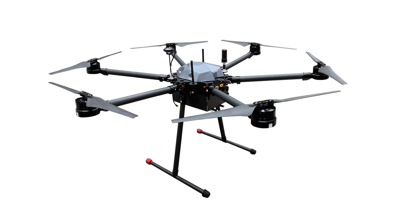
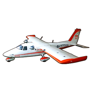
VX2300
It offers long hover time, easy operation, high safety, excellent wind resistance, and simple maintenance. With up to 2 hours of flight endurance, professional-grade maneuverability, and reliable performance that allows takeoff and landing without a runway, it’s truly your ideal partner for any mission.
REPRESENTATIVE for STRONGCO UAV
Yi Long Three-Dimensional Technology Co., Ltd., established in 2014, is a professional UAV company specializing in customized solutions with over 10 years of operational experience. Since 2014, the company has collaborated with leading domestic surveying and mapping firms to conduct numerous aerial photography and flight missions, gaining deep insight into industry needs and providing comprehensive support for various aerial operations.

AERIAL SURVEY
The company operates its own aerial survey aircraft (models: Vulcanair P68C-TC and Britten-Norman BN2), both equipped with twin turbocharged engines to ensure maximum flight safety. Each aircraft is fitted with specialized digital aerial survey cameras, ultra-high-resolution mapping cameras, and airborne LiDAR systems, enabling agile maneuverability and rapid deployment to efficiently complete flight missions. Our dedicated pilots and professional aerial photographers have all passed rigorous factory-certified training and examinations, remaining on standby around the clock to carry out assigned missions.
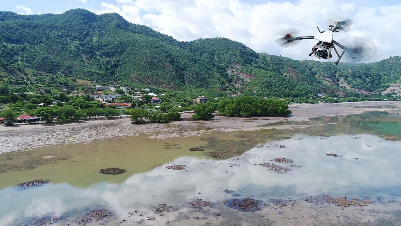
UAV AERIAL FILMING
We assist you in obtaining detailed aerial imagery of small areas, capturing aerial videos and panoramic photos of specific locations. Our UAV aerial photography team delivers precise and high-quality results.
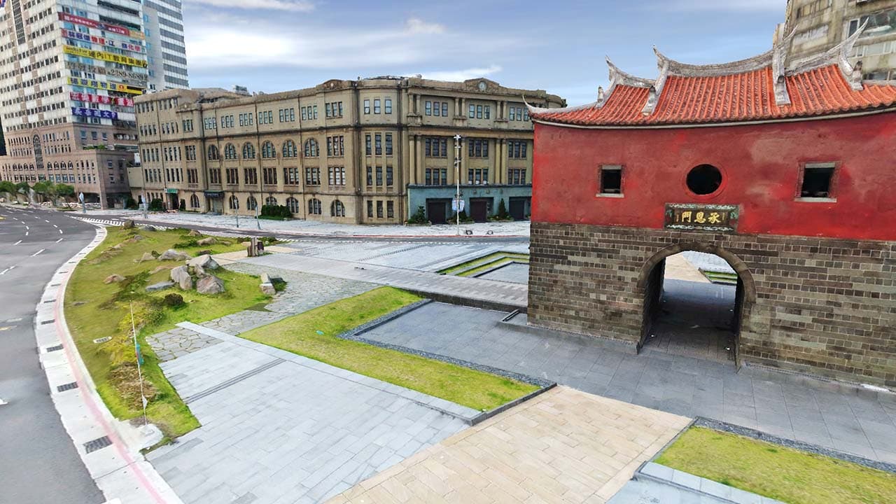
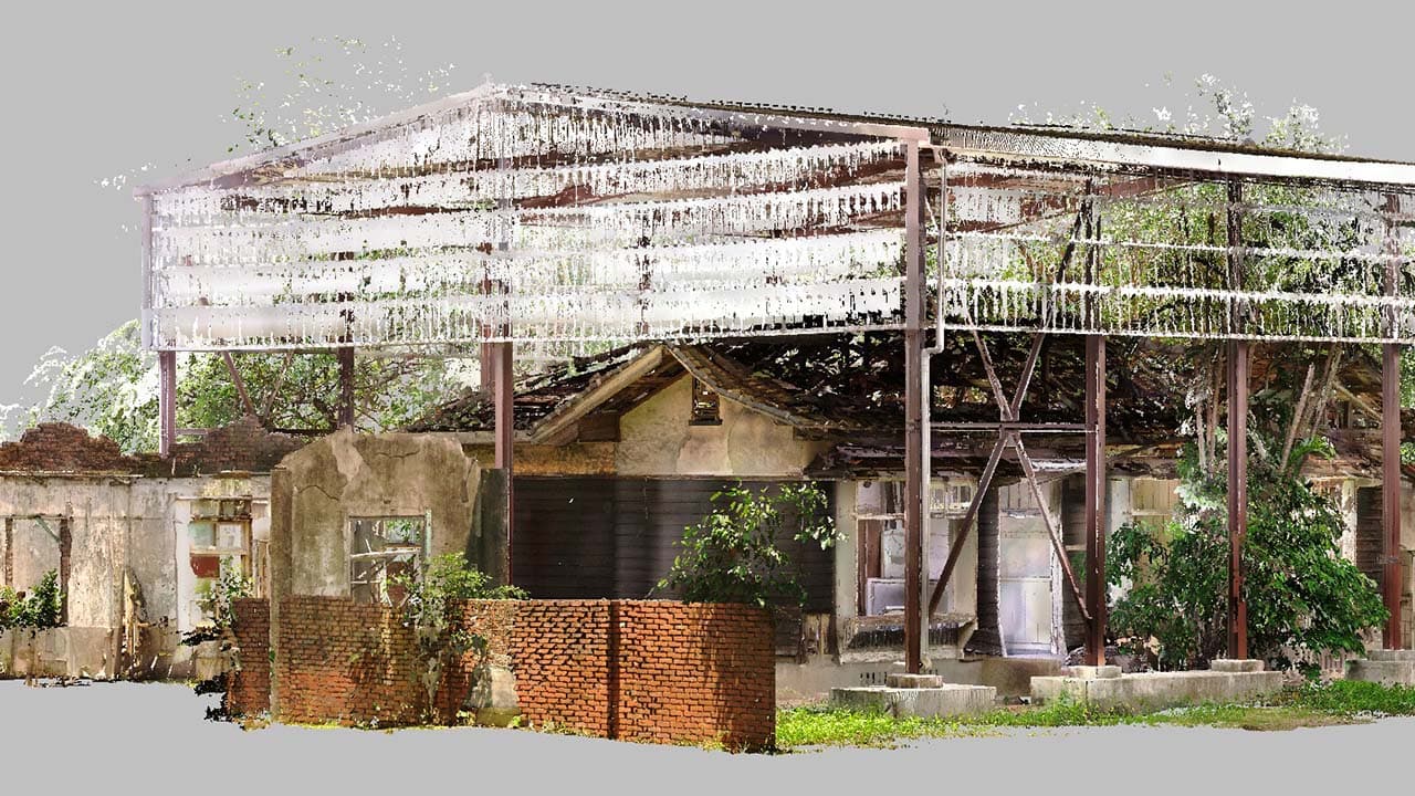
Photogrammetry (3D Reality Capture)
By combining aerial imagery, ground photographs, and point cloud data, we perform advanced post-processing to generate high-fidelity 3D reality models. These models accurately reproduce real-world environments and excel in applications such as urban digitalization, special structure modeling, and cultural heritage preservation.
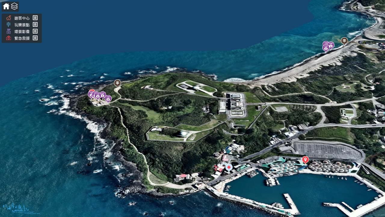
3D/2D GIS
A Geographic Information System (GIS) is a professional data management system that integrates geographic, spatial, temporal, and related mapping information. It functions like an efficient house manager—systematically organizing vast amounts of information and enabling rapid data retrieval for analysis, investigation, measurement, and planning. This empowers project owners to manage projects more effectively, expand application possibilities, and enhance overall productivity.
LASERSCANNING
Laser scanning is an innovative surveying method that breaks through the limitations of traditional measurement techniques. By replacing radio waves with laser beams, it uses a high-speed laser rangefinder and internal scanning prism to accurately capture the three-dimensional coordinates of scanned points, providing the most precise terrain and earthwork volume data available.
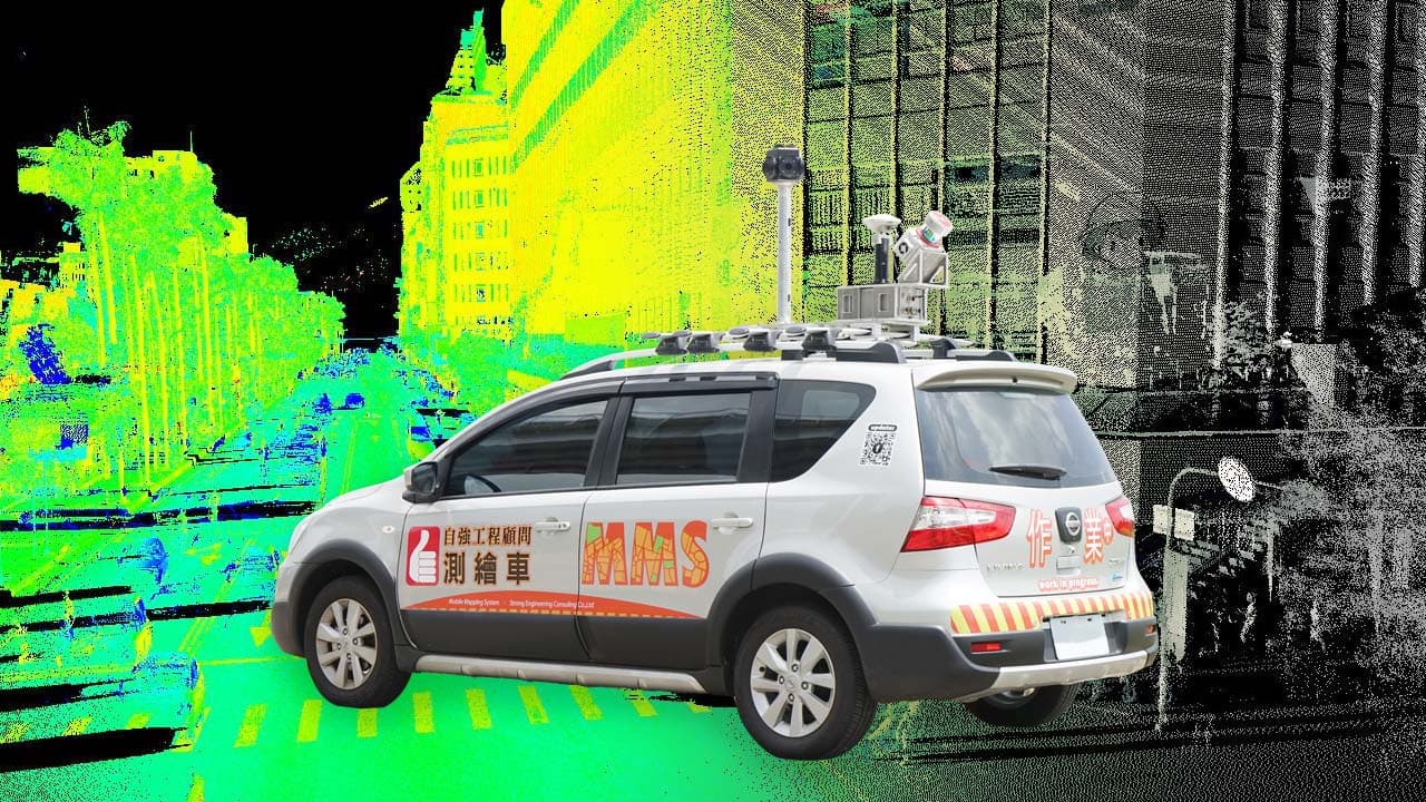
MOBILE MAPPING SYSTEM
The MLS (Mobile LiDAR System) is the first domestically developed and fully integrated long-range, multi-application mobile laser scanning system in Taiwan. It can be deployed on vehicles, vessels, or aircraft, and is equipped with a high-speed laser scanner, panoramic imaging system, and navigation-grade inertial navigation components. This combination delivers highly accurate positioning and orientation performance, enhances post-processing trajectory precision, and effectively resists satellite signal loss or environmental obstructions—making it ideal for tunnel mapping and other high-speed dynamic environments.
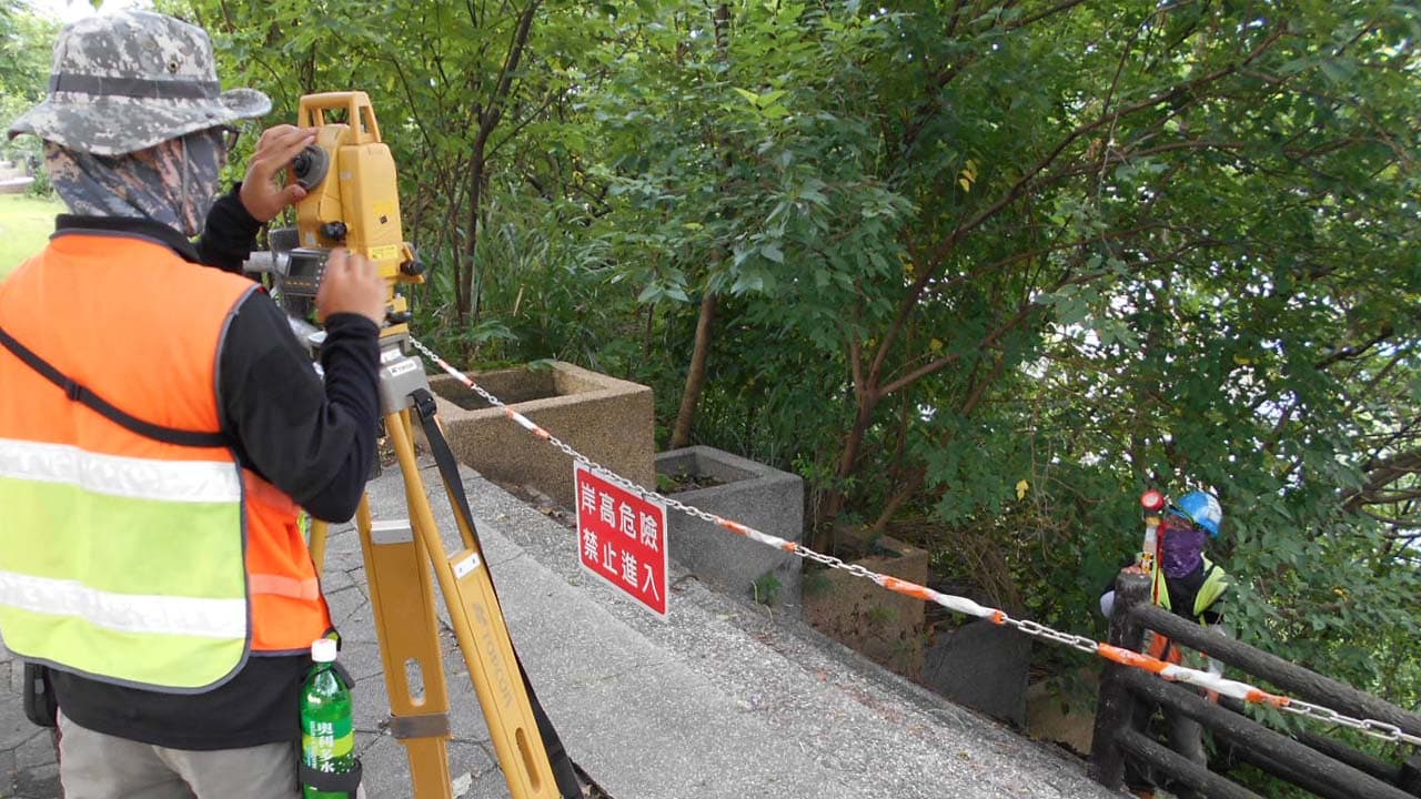
LAND MEASURING
In an era of rapidly evolving surveying technologies, traditional land surveying continues to hold an irreplaceable role. Techniques such as triangulation, leveling, GPS positioning, traverse surveys, engineering surveys, and 3D digital terrain mapping remain precise and reliable, ensuring the highest-quality land surveying results for your projects.
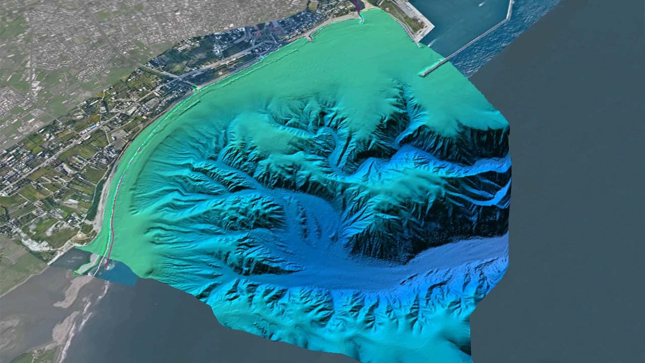
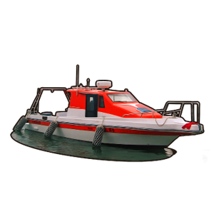
UNDERWATER ACOUSTIC MEASUREMENT
Underwater surveying technology provides the most accurate representation of underwater terrain and elevation. It includes single-beam (Single Beam Echo Sounder) and multi-beam (Multi-Beam Echo Sounder) depth sounding systems, which can be used in oceans, rivers, harbors, coastlines, reservoirs, and ponds to measure underwater depths and reveal a complete picture of the subaqueous landscape.

UNDERWATER ARCHAEDLOGY
Underwater cultural heritage exploration utilizes a combination of technologies—such as Side-Scan Sonar (SSS), high-density bathymetric surveys (Multi-Beam Echo Sounder, MBES), Sub-Bottom Profilers (SBP), magnetic surveys (MAG), and underwater photography and videography—to detect and analyze potential cultural artifacts or remnants beneath the water. Through these advanced underwater exploration methods, researchers can interpret the characteristics, forms, and conditions of identified targets, providing essential data for the preservation, protection, and sustainable development of underwater cultural heritage and related aquatic environments.
PROJECTS
Our Footprints Across Taiwan and Beyond
Since our establishment in 1984,
our company has continuously pursued innovation,
quality, and efficiency across various fields.
Constant improvement is our ultimate goal.
In addition to our extensive project experience throughout Taiwan,
we are also actively expanding into international markets —
achieving today while investing in the future.


CONTACT


E-mail:strong@st2200.com
Phone:02 2225 2200
Address:5F, No.112, Xinmin St., Zhonghe Dist., New Taipei City 23545
Business hours:Monday to Friday, 8:30 AM – 6:00 PM (Closed on holidays)
For quotation inquiries, please feel free to contact us — we will provide complete service information. Thank you.